Understanding the NYC Subway Map
While many mobile mapping applications can display transit lines, it might be useful to understand the official subway map provided by its operator, the MTA.
You can find the official map on the MTA website. Physical maps are also available for free at the station booths in each subway station. Because the map changes a couple of times a year (e.g., due to station closures and repairs) be sure to get the latest map (you can find the map's publication date at the bottom right). The maps looks like this:

Note that the current map's style with the very schematic/straight lines was introduced in late 2025. You might still see some old websites/mobile apps display the previous map's style that had a lot more curved lines, but those are outdated. Here is a cropped version showing just midtown in the current/new design:
The first thing I want to point out is that this map is not drawn to scale. Manhattan is not that wide and Staten Island isn't really that small. The map is intentionally distorted to highlight the subway lines, stations, and the connections between them. Stations might actually be farther apart or closer together than they appear on this map.
The colored lines are obviously the subway lines. On this map you can also find a few of the other commuter lines that are not officially part of the subway, such as Long Island Rail Road (LIRR), Metro-North and AirTrains -- but let's ignore those for now.
As you can see, no subway line ever leaves New York and no physical subway connection exists from Staten Island to the rest of the subway system.
Unlike many other subway systems around the world, there are no zones because you pay the same fare regardless of how far or how long your trip is. The cost of going from one station to a neighboring station (say, a one-minute ride) is the same as traveling from one end of the map to the other (which might take two hours).
The subway lines and services
You might have noticed that subway lines come in "groups of colors". On the map they appear as multiple, adjacent tracks because these related trains share a portion of common track. Below you see an example of the three "red" trains that really run on the same track through the Chambers St station:
The subway trains are grouped into main lines each of which is comprised of several services:
| Train Services | Line Name | Express | Local |
|---|---|---|---|

|
Broadway-7th Avenue |
|
|
|
Lexington Avenue |
|
|
|
Flushing |
|
|

|
8th Avenue |
|
|


|
6th Avenue |
|
|


|
Broadway |
|
|


|
Nassau Street |
|
|

|
14th Street-Canarsie |
|
|

|
Brooklyn-Queens Crosstown |
|
|

|
Various shuttles |
|
As you can see, each line has a name and a specific color. The 8th Ave line for instance is always blue, while the Broadway - 7th Ave line is always red. Don't worry about the line names too much. Even locals often don't know the official name of a given line (and you'll see later why).
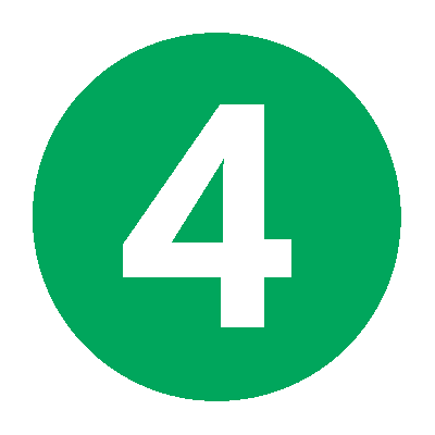
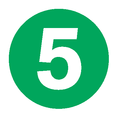
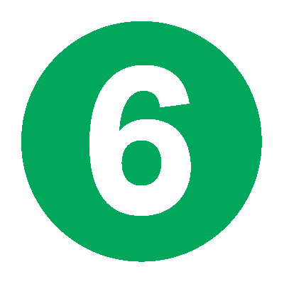
Within each line, there are a few services which are each designated with a single letter or a single number. We refer to these services as just "trains". For instance, within the "red" Broadway-7th Ave line there are three services which are , and . These three services are grouped into this "red" Broadway-7th Ave line, because they share a common tunnel/avenue/street at some point on their journey (parts of Broadway and parts of the 7th Ave). However, these three services have different starting and/or ending stations.
Similarly, the , and services on the "blue" 8th Ave line run along 8th Ave, but they do start and end at different terminals.
On the subway map, you can see these colored service icons only on the terminal stations:
I should pause here and note that while it might be tempting to use these colored lines to describe directions, you ought to be using the single letter/number designation for the specific services instead. It's confusing to say that you are taking the "blue" line, because the three services within the "blue" line (, and ) go to entirely different endpoints (or terminals as we call them) and even stop at different stations on the same shared path. This is the reason why locals don't refer to lines by their names or even color. People never say, "Take the green" or "Take the red line"; Instead we say, "Take the 4 train" or "Take the 2 train". Even though a line and a service have different meanings, you will find that colloquially the word "line" is sometimes used when "service" or "train" is meant. For instance, "Let's take the 4 line to Yankee Stadium" is technically incorrect, but the single number 4 implies that we are talking about the 4 service.
Trains are either express or local. Express trains skip certain stations for faster service, while local trains stop at every station along their path.
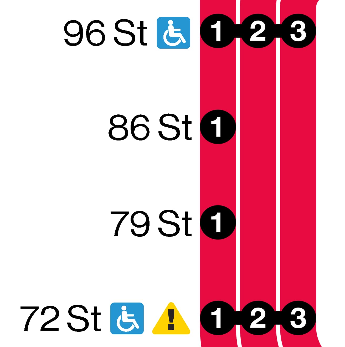
As you can see above the train stops at every station along its path and is therefore referred to as a local train, whereas the and trains skip many "local" stations and stop only at bigger stations such as 96th St and 72nd St. We refer to these trains as "express trains" or trains "running express".
Unfortunately, trains are not reliably express or local along their entire route. An express train can become a local train at some time. This transition is very subtle and you would not even notice while riding the train. The transition from express to local service usually occurs when train services split from their shared portion of the track. For instance, the , and trains share a common track between 96th St station uptown and Chamber St. downtown. Between those two stations, the and trains run express and will skip certain stations. However, right after Chamber St, where the and trains split from the train, they become local trains and will stop at every stop thereafter.
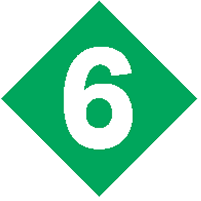
To make matters worse, some train services, such as the or , can either be express or local depending on the time and direction of travel, which is why for those lines only, their icon on the outside of the trains can be either a circle for local () or a diamond for express ().
Don’t worry if this all sounds confusing to you -- it certainly is when you look at it for the first time!
The subway stations
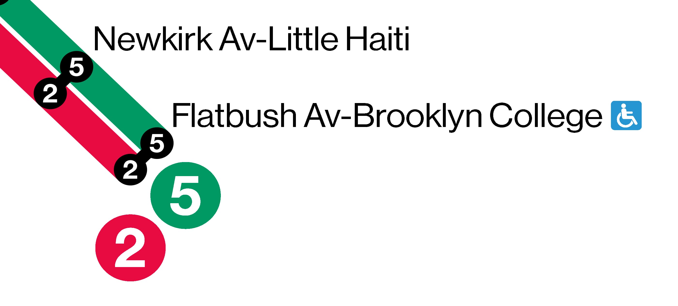
Not surprisingly, subway stations appear as black dots on the subway lines with the station name next to it. Surprisingly, however, subway station names are not unique. See how there are three subway stations named 23rd St and three stations named 14th St in just this area alone:
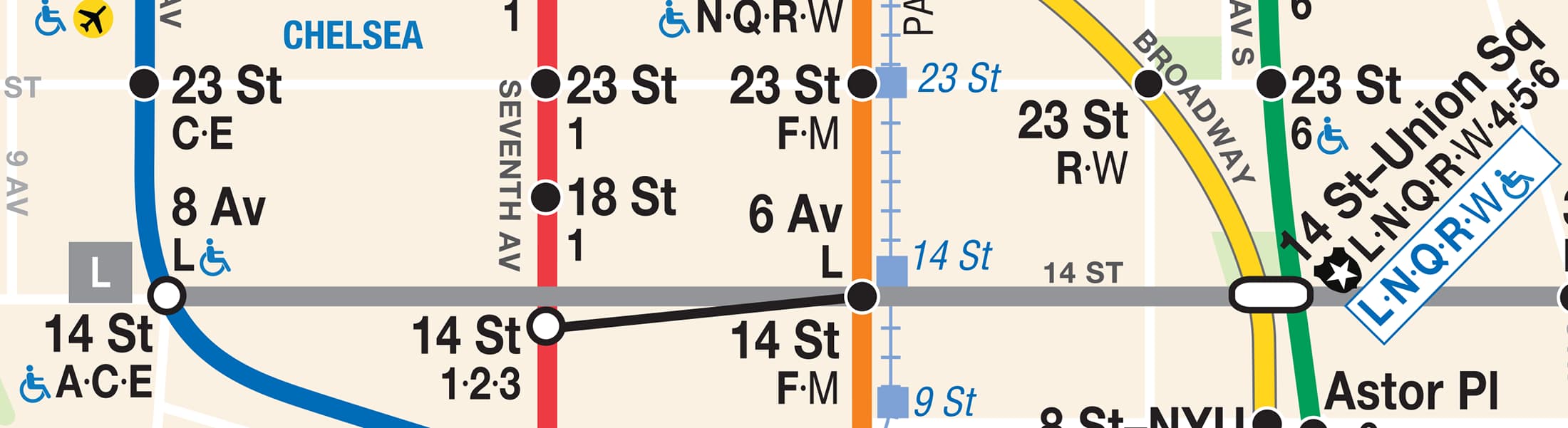
It might be necessary to differentiate them by their subway service: "I am at the 14th St subway station on the A/C/E. Do you want to meet at 14th St station on the 1/2/3 instead"?
A subway station can serve multiple trains. For instance, 34th St-Herald Square subway station is serviced by the 

 as well as the


 trains.
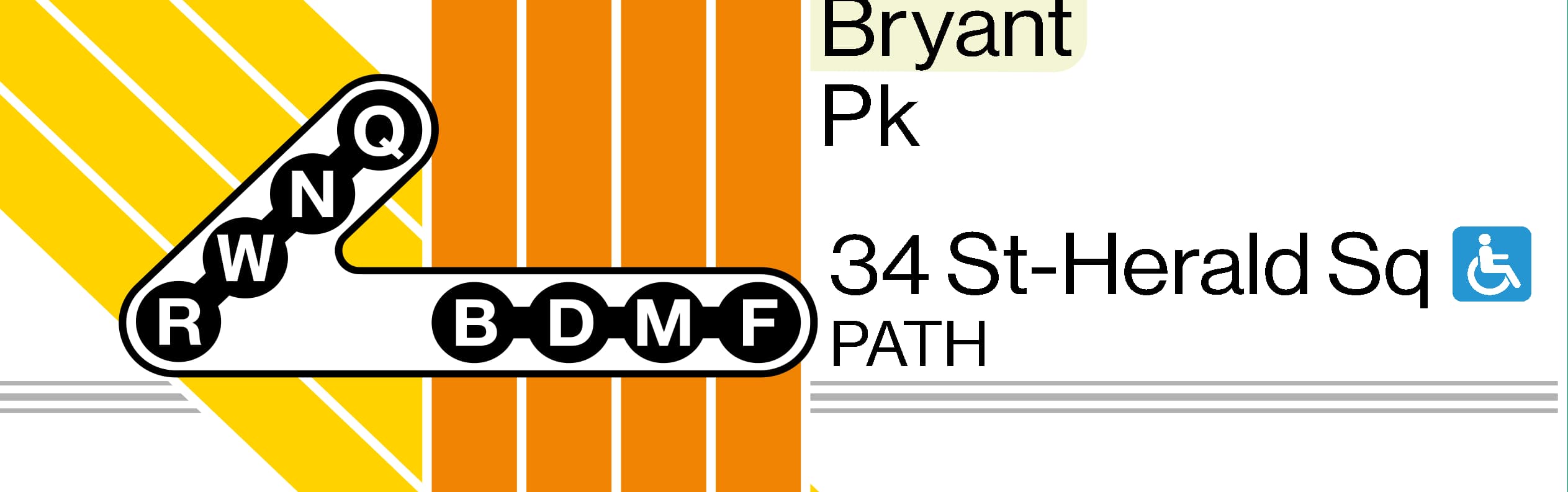
On the map you see them all connected by a white background with a black outline and rounded corners. You can transfer for free between the different trains without having to leave the station and pay a fare again.
A solid black line between two stations means that there exists a physical passageway (usually a tunnel) allowing you to transfer between these stations -- also without leaving the subway system and paying the fare again.
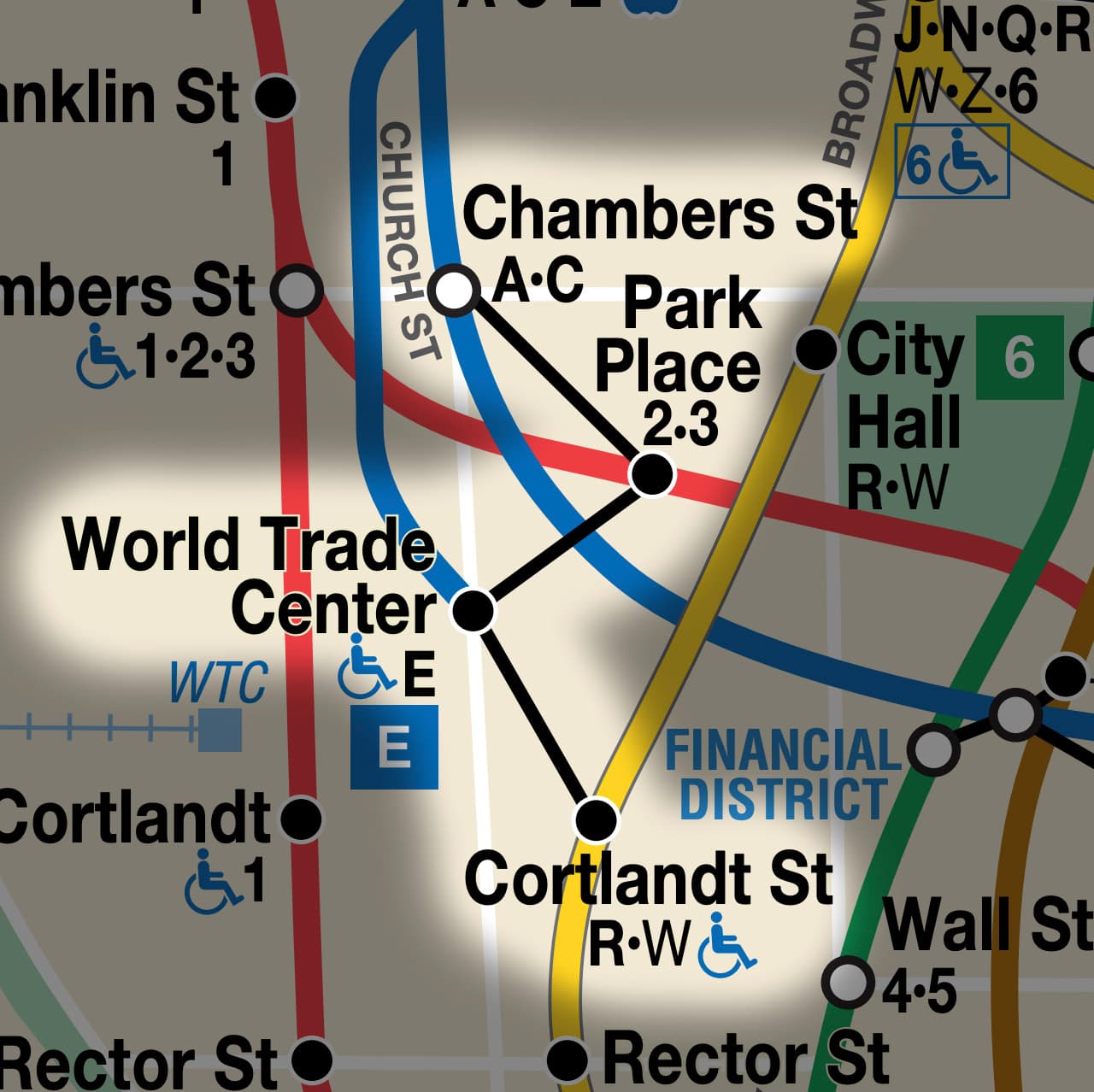
Putting all this knowledge together, I hope you can deduce from the picture above that:
- The and trains stop at Chambers St
- The and trains stop at Park Place
- The train stop at World Trade Center
- The and trains stop at Cortland St
- All four train stations are connected to one another by free underground tunnels and walkways
On rare occasions you will also find this dotted line with a person between stations like this:
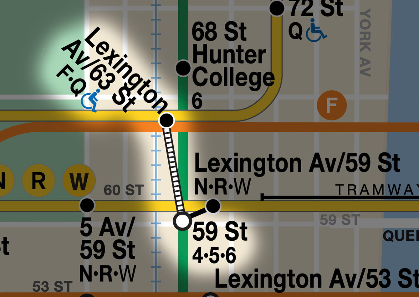
This dotted line between the Lexington Ave/63 St. station and the 59 St. station signal a free out-of-system subway transfer. This is not a physical tunnel or connection. Instead, you exit at one of these subway stations back to the street (without doing anything special), then walk a bit on the surface streets towards the other subway station. As you enter the other station the system will know that you have recently paid a subway fare before and will recognize this as a free transfer and will not charge you again.
Don't expect to understand the New York subway map immediately. It's a dense document conveying perhaps more information than you need to get from point A to point B. The most important thing to remember is that express trains don't stops at every station so remember to double-check that that the train service has a black dot at the station you want to go to.